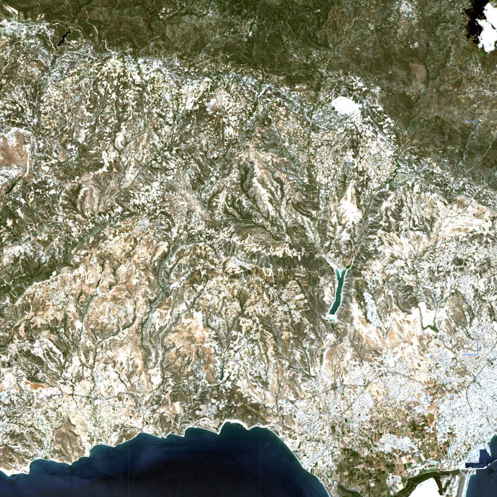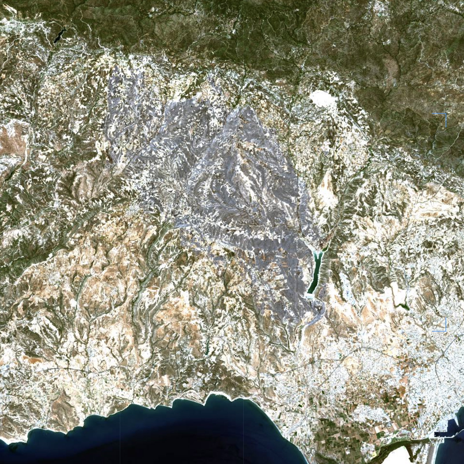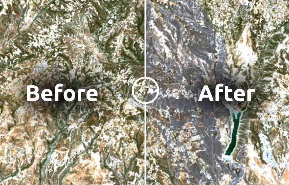
A devastating wildfire swept through the foothills of the Troodos mountains on 23 July 2025, scorching more than 120 km² of forest and farmland in the Limassol district. The blaze forced mass evacuations across at least 14 villages and communities, including Lofou, Vouni, Koilani, Vasa Koilaniou, Pera Pedi, Monagri, Pano Kyvides, Agios Amvrosios, and others. Entire neighborhoods were emptied as emergency sirens urged residents to flee.
Among all these affected areas, the village of Souni (Souni-Zanakia) suffered the most catastrophic damage. Local authorities confirmed that over 90 homes in Souni were destroyed or severely damaged, leaving residents displaced and the village scarred as the epicenter of the disaster. Streets were left lined with burned-out houses and vehicles, making Souni the symbol of this wildfire’s devastation.
The fire also claimed lives and livelihoods. Two people were found dead in a burned vehicle, while 7–10 others were hospitalized with burns and smoke inhalation. Authorities later counted 440 damaged homes (211 completely destroyed) across the wider region, with the number of affected premises eventually climbing to around 700. Over 250 firefighters, 75 fire trucks and 14 aircraft, supported by international crews from Jordan, Israel, Lebanon, Spain, Egypt and Greece, battled the flames until they were brought under control.
We found satellite images before and after the fire to assess its horrific impact.